 Official U.S. government information about the
Global Positioning System (GPS) and related topics
Official U.S. government information about the
Global Positioning System (GPS) and related topics

 56th Meeting of the Civil GPS Service Interface Committee
At the Institute of Navigation GNSS+ 2016 Conference
Oregon Convention Center
Portland, Oregon
September 12-13, 2016
Agenda
(Updated March 23, 2017)
Monday, September 12, 2016
Morning Concurrent Sessions:
· International Information Subcommittee ·
Room A105
Chair: Mr. John Wilde, Global Strategic Sales, NAVBLUE
9:00 a.m.
Introduction
Mr. John Wilde, NAVBLUE
Mr. John Wilde, NAVBLUE
9:05
9:30
9:55
Status of GNSS Research Activities for ATM in Europe
Mr. Gerhard Berz, Senior Navigation Expert, EUROCONTROL
View PDF (581 KB)
Mr. Gerhard Berz, Senior Navigation Expert, EUROCONTROL
View PDF (581 KB)
10:30
Break
10:40
Update on BeiDou Navigation Satellite System (BDS)
Mr. Jun Shen, Deputy Director, International Cooperation Center, China Satellite Navigation Office
View PDF (7 MB)
Mr. Jun Shen, Deputy Director, International Cooperation Center, China Satellite Navigation Office
View PDF (7 MB)
11:05
UK PNT Activities
Mr. Andy Proctor, Lead Technologist Satellite Navigation, Innovate UK
View PDF (834 KB)
Mr. Andy Proctor, Lead Technologist Satellite Navigation, Innovate UK
View PDF (834 KB)
11:30
12:00 p.m.
Discussion Q&A
12:30
Session End
· U.S. State and Local Government Subcommittee ·
Room A106
Chair: Mr. James Arnold, U.S. Department of Transportation
Co-Chair and Secretary: Joseph White, Maryland State Highway Administration
9:00 a.m.
Introductions, Opening and Administrative Items
Mr. James Arnold, U.S. Department of Transportation
Mr. James Arnold, U.S. Department of Transportation
9:10
9:20
9:50
10:20
Break
10:40
The Future of the Plate Boundary Observatory (PBO) Geodetic Resource From Now to 2028
Mr. Ken Austin, UNAVCO
View PDF (14 MB)
Mr. Ken Austin, UNAVCO
View PDF (14 MB)
11:10
Testing PPP-RTK for RTN Integrity and Remote Projects
Gavin Schrock, Seattle Public Utilities
View PDF (5 MB)
Gavin Schrock, Seattle Public Utilities
View PDF (5 MB)
11:40
State Reports
12:00 p.m.
Discussion Q&A
12:30
Session End
Afternoon Concurrent Sessions:
· Timing Subcommittee ·
Room A105
Chair: Dr. Włodzimierz Lewandowski, Polish Central Office of Measures (GUM)
Co-Chair: Mr. Michael Lombardi, National Institute of Standards and Technology (NIST)
2:00 p.m.
2:10
2:30
2:55
Report from the National Institute of Standards and Technology (NIST)
Mr. Michael Lombardi, NIST
View PDF (3 MB)
Mr. Michael Lombardi, NIST
View PDF (3 MB)
3:20
Break
3:40
4:00
How Industry Utilizes GPS for Traceable Frequency Measurements and Calibrations
Mr. Jeff Gust, Chief Corporate Metrologist, Fluke Calibration
View PDF (1 MB)
Mr. Jeff Gust, Chief Corporate Metrologist, Fluke Calibration
View PDF (1 MB)
4:20
New, Robust, High-Performance GPS Timing Receiver
Mr. Bruce Penrod, EndRun Technologies
View PDF (1 MB)
Mr. Bruce Penrod, EndRun Technologies
View PDF (1 MB)
4:40
GPS and Time Synchronization in the Electric Industry
Ms. Alison Silverstein, North American SynchroPhasor Initiative (NASPI)
View PDF (995 KB)
Ms. Alison Silverstein, North American SynchroPhasor Initiative (NASPI)
View PDF (995 KB)
5:00
Using GPS Precise Point Positioning to Test the Theory of Relativity
Dr. Demetrios Matsakis, USNO
View PDF (1024 KB)
Dr. Demetrios Matsakis, USNO
View PDF (1024 KB)
5:20
Group Discussion
5:30
Session End
· Surveying, Mapping, and Geosciences Subcommittee ·
Room A106
Chair: Dr. Giovanni Sella, National Oceanic and Atmospheric Administration (NOAA), National Geodetic Survey
2:00 p.m.
2:10
Recommended Procedure for Post-Processing Static GPS
Surveys in OPUS-Projects
Mr. Dan Gillins, Mr. Daren Kerr, Oregon State University; and Mark Armstrong, NOAA, National Geodetic Survey
View PDF (3 MB)
Mr. Dan Gillins, Mr. Daren Kerr, Oregon State University; and Mark Armstrong, NOAA, National Geodetic Survey
View PDF (3 MB)
2:40
GPS Adjacent Band Compatibility Program
Mr. Karl Shallberg, Zeta Associates; Mr. Hadi Wassaf, USDOT/Volpe Center; and Mr. Stephen Mackey, USDOT/Volpe Center
View PDF (631 KB)
Mr. Karl Shallberg, Zeta Associates; Mr. Hadi Wassaf, USDOT/Volpe Center; and Mr. Stephen Mackey, USDOT/Volpe Center
View PDF (631 KB)
3:00
GIS Data Attribution: Mitigating "Death by GPS"
Mr. Rick Hamilton, U.S. Coast Guard Navigation Center
View PDF (3 MB)
Mr. Rick Hamilton, U.S. Coast Guard Navigation Center
View PDF (3 MB)
3:20
Break
3:40
From Decadal Time Series to High Rate Real-Time Data Streams: The Temporal Spectrum of GNSS Data and Products from UNAVCO and the EarthScope Plate Boundary Observatory (PBO)
Mr. David Philips, UNAVCO
Mr. David Philips, UNAVCO
4:20
Space Weather Action Plan and the GPS/GNSS User Community
Mr. Robert Steenburgh, NOAA, National Weather Service
View PDF (518 KB)
Mr. Robert Steenburgh, NOAA, National Weather Service
View PDF (518 KB)
4:40
Reanalysis of CORS Network GPS Data Tied to a Global Frame
Kevin Choi, NOAA, National Geodetic Survey
View PDF (2 MB)
Kevin Choi, NOAA, National Geodetic Survey
View PDF (2 MB)
5:00
Group Discussion
5:30
Session End
Tuesday, September 13, 2016
Plenary Session
· Civil GPS Service Interface Committee ·
Room A105/A106
9:00 a.m.
Welcome/Opening
Ms. Karen Van Dyke, Director, PNT and Spectrum Management, U.S. Department of Transportation, CGSIC Chair
Ms. Karen Van Dyke, Director, PNT and Spectrum Management, U.S. Department of Transportation, CGSIC Chair
9:05
Meeting Overview
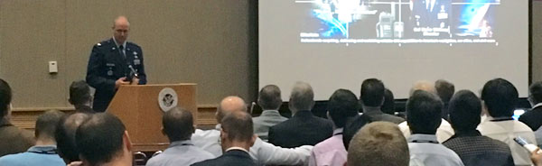
Captain Russell E. Holmes, Commanding Officer, U.S. Coast Guard Navigation Center (NAVCEN), CGSIC Deputy Chair
View PDF (701 KB)
Captain Russell E. Holmes, Commanding Officer, U.S. Coast Guard Navigation Center (NAVCEN), CGSIC Deputy Chair
View PDF (701 KB)
9:10
Keynote Address
Brigadier General Mark Baird, Vice Commander, USAF Space and Missile Systems Center, Los Angeles Air Force Base
Brigadier General Mark Baird, Vice Commander, USAF Space and Missile Systems Center, Los Angeles Air Force Base
9:30
U.S. National Space-Based PNT Update
Mr. Harold Martin, Director, National Coordination Office for Space-Based Positioning, Navigation, and Timing
View PDF (764 KB)
Mr. Harold Martin, Director, National Coordination Office for Space-Based Positioning, Navigation, and Timing
View PDF (764 KB)
9:50
GPS Program Update
Colonel Steven P. Whitney, Director, U.S. Air Force GPS Directorate
View PDF (3 MB)
Colonel Steven P. Whitney, Director, U.S. Air Force GPS Directorate
View PDF (3 MB)
10:10
GPS Constellation Status and Performance
Major Choate Wilson, Director of Operations, USAF Second Space Operations Squadron
View PDF (537 KB)
Major Choate Wilson, Director of Operations, USAF Second Space Operations Squadron
View PDF (537 KB)
10:30
Break
10:45
U.S. GPS/GNSS International Activities Update
Mr. Jeffrey M. Auerbach, Senior GNSS Advisor, U.S. Department of State, Office of Space and Advanced Technology
View PDF (544 KB)
Mr. Jeffrey M. Auerbach, Senior GNSS Advisor, U.S. Department of State, Office of Space and Advanced Technology
View PDF (544 KB)
11:10
DHS PNT Update
Mr. John Dragseth, Office of Infrastructure Protection, National Protection and Programs Directorate, U.S. Department of Homeland Security
View PDF (2 MB)
Mr. John Dragseth, Office of Infrastructure Protection, National Protection and Programs Directorate, U.S. Department of Homeland Security
View PDF (2 MB)
11:35
Q/A Panel
Presenters
Presenters
12:00 p.m.
Lunch
1:30
Subcommittee Reports from Chairperson:
- International Information Subcommittee
Mr. John Wilde, NAVBLUE
View PDF (177 KB) - Timing Subcommittee
Dr. Włodzimierz Lewandowski, Polish Central Office of Measures
View PDF (253 KB) - U.S. State and Local Government Subcommittee
Mr. James Arnold, U.S. Department of Transportation
View PDF (162 KB) - Surveying, Mapping, and Geosciences Subcommittee
Dr. Giovanni Sella, NOAA, National Geodetic Survey
View PDF (300 KB)
2:10
Navigation Programs Update
Ms. Deborah Lawrence, Navigation Programs Manager, Federal Aviation Administration, U.S. Department of Transportation
View PDF (4 MB)
Ms. Deborah Lawrence, Navigation Programs Manager, Federal Aviation Administration, U.S. Department of Transportation
View PDF (4 MB)
2:30
NDGPS Program Update
Mr. James Arnold, U.S. Department of Transportation; and Captain Russell Holmes, U.S. Coast Guard
View PDF (999 KB)
Mr. James Arnold, U.S. Department of Transportation; and Captain Russell Holmes, U.S. Coast Guard
View PDF (999 KB)
2:50
GPS User Support Forum: GPS UTC Offset Event
Mr. Hank Skalski, GPS Civil Liaison, USAF Space Command (moderator)
Panel of experts from USAF and NAVCEN
Mr. Hank Skalski, GPS Civil Liaison, USAF Space Command (moderator)
Panel of experts from USAF and NAVCEN
3:30
Break
3:50
NGA Support to Civilian PNT
Mr. Robert Wong, Senior Analyst, GNSS Division, National Geospatial-Intelligence Agency
View PDF (2 MB)
Mr. Robert Wong, Senior Analyst, GNSS Division, National Geospatial-Intelligence Agency
View PDF (2 MB)
4:10
Adjacent Band Compatibility Assessment
Ms. Karen Van Dyke, Mr. Stephen Mackey, and Mr. Hadi Wassaf, U.S. Department of Transportation
View PDF (821 KB)
Ms. Karen Van Dyke, Mr. Stephen Mackey, and Mr. Hadi Wassaf, U.S. Department of Transportation
View PDF (821 KB)
4:30
GPS User Perspectives
Open Forum
Open Forum
5:00
Q/A Panel
Presenters
Presenters
5:30
Adjourn


