 Official U.S. government information about the
Global Positioning System (GPS) and related topics
Official U.S. government information about the
Global Positioning System (GPS) and related topics
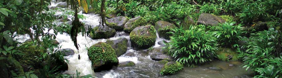
To sustain the Earth's environment while balancing human needs requires better decision making with more up-to-date information. Gathering accurate and timely information has been one of the greatest challenges facing both government and private organizations that must make these decisions. The Global Positioning System (GPS) helps to address that need.
Data collection systems provide decision makers with descriptive information and accurate positional data about items that are spread across many kilometers of terrain. By connecting position information with other types of data, it is possible to analyze many environmental problems from a new perspective. Position data collected through GPS can be imported into geographic information system (GIS) software, allowing spatial aspects to be analyzed with other information to create a far more complete understanding of a particular situation than might be possible through conventional means.
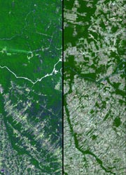 Before and after imagery of Amazon deforestation
Aerial studies of some of the world's most impenetrable wilderness are conducted with the aid of GPS technology to evaluate an area’s wildlife, terrain, and human infrastructure. By tagging imagery with GPS coordinates it is possible to evaluate conservation efforts and assist in strategy planning.
Some nations collect and use mapping information to manage their regulatory programs such as the control of royalties from mining operations, delineation of borders, and the management of logging in their forests.
GPS technology supports efforts to understand and forecast changes in the environment. By integrating GPS measurements into operational methods used by meteorologists, the atmosphere’s water content can be determined, improving the accuracy of weather forecasts. In addition, the proliferation of GPS tidal tracking sites, and improvement in estimating the vertical component of a site’s position from GPS measurements, present a unique opportunity to directly observe the effects of ocean tides.
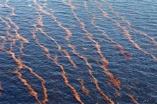 In 2010, GPS helped cleanup crews respond to the massive oil leak in the Gulf of Mexico.
GPS receivers mounted on buoys track the movement and spread of oil spills. Helicopters use GPS to map the perimeter of forest fires and allow efficient use of fire fighting resources.
The migratory patterns of endangered species, such as the mountain gorillas of Rwanda, are tracked and mapped using GPS, helping to preserve and enhance declining populations.
In earthquake prone areas such as the Pacific Rim, GPS is playing an increasingly prominent role in helping scientists to anticipate earthquakes. Using the precise position information provided by GPS, scientists can study how strain builds up slowly over time in an attempt to characterize, and in the future perhaps anticipate, earthquakes.
 Endangered monk seal with GPS-enabled tracking device
Another benefit to using GPS is timeliness with which critical products can be generated. Because GPS data are in a digital form available at all times and in all parts of the world, they can be captured and analyzed very quickly. This means that it is possible for analysis to be completed in hours or days rather than weeks or months, thus ensuring that the final product is timelier. With the rapid pace of change in the world today, these savings in time can be critical.
The modernization of GPS will further enhance the support of GPS technology to the study and management of the world’s environment. The United States is committed to implementing two additional civilian signals that will provide ecological and conservation applications with increased accuracy, availability, and reliability. Tropical rain forest ecology, for example, will benefit from the increased availability of GPS within heavy foliage areas and the reduction of spatial error in fine-scale vegetation mapping.
Note: The main text of this page has not been updated since 2006.
Benefits
- GPS data collection systems complemented with GIS packages provide a means for comprehensive analysis of environmental concerns.
- Environmental patterns and trends can be efficiently recognized with GPS/GIS data collection systems, and thematic maps can be easily created.
- GPS data can be quickly analyzed without the preliminary requirement for field data transcription into a digitized form.
- Accurate tracking of environmental disasters such as fires and oil spills can be conducted more efficiently.
- Precise positional data from GPS can assist scientists in crustal and seismic monitoring.
- Monitoring and preservation of endangered species can be facilitated through GPS tracking and mapping.
“Until the advent of GPS tracking, it was practically impossible to record elephant movements with sufficient temporal resolution to give a full picture of movement patterns. The presence of elephants in Kenya is a key indicator of the health of the environment.”
Honorable Dr. Newton Kulundu, Minister for Environment, Natural Resources, and Wildlife, Kenya


