 Official U.S. government information about the
Global Positioning System (GPS) and related topics
Official U.S. government information about the
Global Positioning System (GPS) and related topics

 55th Meeting of the Civil GPS Service Interface Committee
At the Institute of Navigation GNSS+ 2015 Conference
Tampa Convention Center
14-15 September 2015
Agenda
Monday, 14 September 2015
8:15 a.m.
Registration
Morning Concurrent Sessions:
· Timing Subcommittee ·
Chair: Dr. Włodzimierz Lewandowski, European Space Agency (ESA) Navigation Program Board (PB-Nav)
Co-Chair: Dr. Victor Zhang, National Institute of Standards and Technology (NIST)
9:00 a.m.
9:10
9:30
10:00
Report from APL
Dr. Mihran Miranian, The Johns Hopkins University Applied Physics Laboratory (APL)
View PDF (4 MB)
Dr. Mihran Miranian, The Johns Hopkins University Applied Physics Laboratory (APL)
View PDF (4 MB)
10:20
Break
10:40
Delivering NIST Time to Financial Markets via Common-View GPS Measurements
Dr. Mike Lombardi, NIST
View PDF (1 MB)
Dr. Mike Lombardi, NIST
View PDF (1 MB)
11:00
11:20
A Common Clock Reference For All GNSS: An Update
Dr. Tom Stansell, Stansell Consulting
Dr. Tom Stansell, Stansell Consulting
11:40
Time and Navigation Exhibition at the Smithsonian: Progress Report
Ms. Carlene Stephens, Mr. Andrew Johnston, National Museum of American History
View PDF (1 MB)
Ms. Carlene Stephens, Mr. Andrew Johnston, National Museum of American History
View PDF (1 MB)
12:00 p.m.
Discussion
12:30
Session End
· U.S. State and Local Government Subcommittee ·
Chair: Mr. James Arnold, U.S. Department of Transportation
Co-Chair and Secretary: Joseph White, Maryland State Highway Administration
9:00 a.m.
9:10
9:30
Getting Ready for Connected and Automated Vehicles
Mr. James Arnold, U.S. Department of Transportation
View PDF (2 MB)
Mr. James Arnold, U.S. Department of Transportation
View PDF (2 MB)
9:55
10:20
Break
10:40
Harris Signal Sentry GPS Interference Detection and Geo-location Technology
Mr. Joseph Rolli, Harris Corporation
View PDF (3 MB)
Mr. Joseph Rolli, Harris Corporation
View PDF (3 MB)
11:10
State Reports
Any State present
Any State present
12:00 p.m.
Discussion Q&A
12:30
Session End
Afternoon Concurrent Sessions:
· International Information Subcommittee ·
Chair: Mr. John Wilde, Vice President Commercial, Navtech
2:00 p.m.
2:15
Australian Transition to Satellite Based CNS/ATM
Mr. Ian Mallett, Section Head, CASA Australia
View PDF (4 MB)
Mr. Ian Mallett, Section Head, CASA Australia
View PDF (4 MB)
2:35
Galileo Precise Point Positioning
Prof. Richard Langley, Department of Geodesy and Geomatics Engineering, University of New Brunswick
View PDF (1 MB)
Prof. Richard Langley, Department of Geodesy and Geomatics Engineering, University of New Brunswick
View PDF (1 MB)
2:55
Use of Four GNSS in an Operational Precise Point Positioning Service
Mr. Lee Ott, Chief Scientist, Fugro Satellite Positioning
View PDF (2 MB)
Mr. Lee Ott, Chief Scientist, Fugro Satellite Positioning
View PDF (2 MB)
3:20
Break
3:40
GNSS RFI Mitigation Efforts in Europe
Mr. Pascal Barret, Navigation & CNS Research Senior Expert, EUROCONTROL
View PDF (490 KB)
Mr. Pascal Barret, Navigation & CNS Research Senior Expert, EUROCONTROL
View PDF (490 KB)
4:00
Paving the Way for Galileo…GNSS Monitoring for Critical Applications
Mr. John Wilde, Vice President Commercial, Navtech
View PDF (2 MB)
Mr. John Wilde, Vice President Commercial, Navtech
View PDF (2 MB)
4:30
General Questions
5:30
Session End
· Surveying, Mapping, and Geosciences Subcommittee ·
Chair: Dr. Giovanni Sella, National Oceanic and Atmospheric Administration (NOAA), National Geodetic Survey
2:00 p.m.
2:05
Precise GPS Orbit Determination: How and Why
Dr. SungPil Yoon, NOAA, National Geodetic Survey
View PDF (452 KB)
Dr. SungPil Yoon, NOAA, National Geodetic Survey
View PDF (452 KB)
2:25
EarthScope LiDAR and Plate Boundary Observatory (PBO) GPS Data, Products and Services
Dr. David Phillips, UNAVCO
View PDF (35 MB)
Dr. David Phillips, UNAVCO
View PDF (35 MB)
2:50
NOAA Space Weather Prediction Center -- Progress on Space Weather Products and Services for the GPS/GNSS Community
Dr. Robert Steenburgh, NOAA, Space Weather Prediction Center
View PDF (4 MB)
Dr. Robert Steenburgh, NOAA, Space Weather Prediction Center
View PDF (4 MB)
3:20
Break
3:40
Coastal Subsidence along the Eastern Seaboard and Gulf of Mexico
Dr. Timothy H. Dixon, University of South Florida (USF), Dr. Makan A. Karegar, USF, Dr. Rocco Malservisi, USF, Dr. Simon E. Engelhart, University of Rhode Island
View PDF (2 MB)
Dr. Timothy H. Dixon, University of South Florida (USF), Dr. Makan A. Karegar, USF, Dr. Rocco Malservisi, USF, Dr. Simon E. Engelhart, University of Rhode Island
View PDF (2 MB)
4:00
Work Towards a Geometric and Vertical Reference Frame by 2022
Dr. Daniel R. Roman, NOAA, National Geodetic Survey
View PDF (2 MB)
Dr. Daniel R. Roman, NOAA, National Geodetic Survey
View PDF (2 MB)
4:35
Final Comments and Q&A
Dr. Giovanni Sella, NOAA, National Geodetic Survey
Dr. Giovanni Sella, NOAA, National Geodetic Survey
5:00
General Questions
5:30
Session End
Tuesday, 15 September 2015
8:00 a.m.
Registration
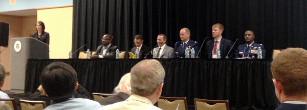
CGSIC Plenary Session
9:00
Welcome/Opening
Ms. Karen Van Dyke, U.S. Department of Transportation, Chair, CGSIC
Ms. Karen Van Dyke, U.S. Department of Transportation, Chair, CGSIC
9:05
Meeting Overview
Captain Russell E. Holmes, Commanding Officer, U.S. Coast Guard Navigation Center (NAVCEN), Deputy Chair
View PDF (615 KB)
Captain Russell E. Holmes, Commanding Officer, U.S. Coast Guard Navigation Center (NAVCEN), Deputy Chair
View PDF (615 KB)
9:10
Keynote Address
The Honorable Gregory D. Winfree, Assistant Secretary for Research and Technology, U.S. Department of Transportation
View PDF (195 KB)
The Honorable Gregory D. Winfree, Assistant Secretary for Research and Technology, U.S. Department of Transportation
View PDF (195 KB)
9:30
U.S. National Space-Based PNT Update
Mr. Harold Martin, Director, National Coordination Office for Space-Based Positioning, Navigation, and Timing
View PDF (1 MB)
Mr. Harold Martin, Director, National Coordination Office for Space-Based Positioning, Navigation, and Timing
View PDF (1 MB)
9:50
GPS Constellation Status and Performance
Major Roland Rainey, Jr., Director of Operations, U.S. Air Force Second Space Operations Squadron
View PDF (1 MB)
Major Roland Rainey, Jr., Director of Operations, U.S. Air Force Second Space Operations Squadron
View PDF (1 MB)
10:10
GPS Program Update
Colonel Steven P. Whitney, Director, U.S. Air Force GPS Directorate
View PDF (2 MB)
Colonel Steven P. Whitney, Director, U.S. Air Force GPS Directorate
View PDF (2 MB)
10:30
Break
10:45
GPS International Activities
Mr. Jeffrey M. Auerbach, Senior GNSS Advisor, U.S. Department of State, Office of Space and Advanced Technology
View PDF (798 KB)
Mr. Jeffrey M. Auerbach, Senior GNSS Advisor, U.S. Department of State, Office of Space and Advanced Technology
View PDF (798 KB)
11:10
U.S. Interference Detection & Mitigation Plan (IDM)
Mr. John Dragseth, National Protection and Programs Directorate, U.S. Department of Homeland Security
View PDF (2 MB)
Mr. John Dragseth, National Protection and Programs Directorate, U.S. Department of Homeland Security
View PDF (2 MB)
11:35
Q/A Panel
12:00 p.m.
Lunch
1:30
Subcommittee Reports
- International Information Subcommittee
Mr. John Wilde, DW International
View PDF (185 KB) - Timing Subcommittee
Dr. Włodzimierz Lewandowski, ESA Navigation Program Board
View PDF (361 KB) - U.S. State and Local Government Subcommittee
Mr. James Arnold, U.S. Department of Transportation
View PDF (160 KB) - Surveying, Mapping, and Geosciences Subcommittee
Mr. Giovanni Sella, NOAA, National Geodetic Survey
View PDF (542 KB)
2:10
PBN Strategy & Resiliency Initiatives
Ms. Deborah Lawrence, Manager, Navigation Programs, Federal Aviation Administration, U.S. Department of Transportation
View PDF (4 MB)
Ms. Deborah Lawrence, Manager, Navigation Programs, Federal Aviation Administration, U.S. Department of Transportation
View PDF (4 MB)
2:30
NDGPS Program Update
Mr. James Arnold, U.S. Department of Transportation; Lieutenant Torrey Jacobsen, U.S. Coast Guard DGPS Program Manager
View PDF (692 KB)
Mr. James Arnold, U.S. Department of Transportation; Lieutenant Torrey Jacobsen, U.S. Coast Guard DGPS Program Manager
View PDF (692 KB)
2:50
GPS Launch, Anomaly and Disposal Operations
Lieutenant Colonel Sam Baxter, U.S. Air Force Nineteenth Space Operations Squadron
View PDF (1 MB)
Lieutenant Colonel Sam Baxter, U.S. Air Force Nineteenth Space Operations Squadron
View PDF (1 MB)
3:10
A new GPS sensor for monitoring ocean wave dynamics and space weather
from remote buoys and ships
Mr. Joseph Kunches, Director of Space Weather Services, ASTRA LLC, Boulder Colorado
View PDF (4 MB)
Mr. Joseph Kunches, Director of Space Weather Services, ASTRA LLC, Boulder Colorado
View PDF (4 MB)
3:30
Break
3:50
User Support Forum
- NPEF Civil Navigation (CNAV) Message Validation Task
Dean Bunce, FAA
View PDF (122 KB)
4:10
Update on NASA GPS applications for space operations and science
Mr. James Miller, NASA
View PDF (3 MB)
Mr. James Miller, NASA
View PDF (3 MB)
4:30
Use of GPS for ICAO's Global Tracking initiative in the wake of MH370
Mr. Ed Williams, AirServices Australia
View PDF (1 MB)
Mr. Ed Williams, AirServices Australia
View PDF (1 MB)
5:00
Adjourn


