 Official U.S. government information about the
Global Positioning System (GPS) and related topics
Official U.S. government information about the
Global Positioning System (GPS) and related topics
Control Segment

On this page:
The GPS control segment consists of a global network of ground facilities that track the GPS satellites, monitor their transmissions, perform analyses, and send commands and data to the constellation.
The current Operational Control Segment (OCS) includes a master control station, an alternate master control station, 11 command and control antennas, and 16 monitoring sites. The locations of these facilities are shown in the map above. View as PDF (111 KB)
Air Force Personnel: Team Blackjack
 The GPS constellation delivers consistently high performance thanks to the dedicated efforts of its operators — the men and women of the U.S. Air Force's 2nd Space Operations Squadron (2SOPS) and the Air Force Reserve's 19th Space Operations Squadron (19SOPS) at Schriever Space Force Base, Colorado.
Together, 2SOPS and 19SOPS — nicknamed Team Blackjack — keep the GPS satellites flying on a 24/7 basis, with continuous availability and high accuracy for billions of civilian and military users.
More Information
- 2SOPS fact sheet (spaceforce.mil)
- 19SOPS fact sheet (AF.mil)
- Feb 2016: "Masters of Space" keep GPS constellation grounded and on time (AF.mil)
Control Segment Elements
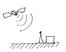
Monitor Stations
- Track GPS satellites as they pass overhead
- Collect navigation signals, range/carrier measurements, and atmospheric data
- Feed observations to the master control station
- Utilize sophisticated GPS receivers
- Provide global coverage via 16 sites: 6 from the Air Force plus 10 from NGA

Master Control Station
- Provides command and control of the GPS constellation
- Uses global monitor station data to compute the precise locations of the satellites
- Generates navigation messages for upload to the satellites
- Monitors satellite broadcasts and system integrity to ensure constellation health and accuracy
- Performs satellite maintenance and anomaly resolution, including repositioning satellites to maintain optimal constellation
- Currently uses separate systems (AEP & LADO) to control operational and non-operational satellites
- Backed up by a fully operational alternate master control station
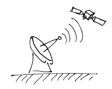
Ground Antennas
- Send commands, navigation data uploads, and processor program loads to the satellites
- Collect telemetry
- Communicate via S-band and perform S-band ranging to provide anomaly resolution and early orbit support
- Consist of 4 dedicated GPS ground antennas plus 7 Air Force Satellite Control Network (AFSCN) remote tracking stations
Control Segment Modernization
 As part of the GPS modernization program, the Air Force has continuously upgraded the GPS control segment for many years. The ground upgrades are necessary to command and control the newer GPS satellites and to enhance cybersecurity.
Ongoing Upgrades
- OCX: Next Generation Operational Control System
- COps: GPS III Contingency Operations
- MCEU: M-Code Early Use
Past Upgrades
- AEP: Architecture Evolution Plan
- LADO: Launch/Early Orbit, Anomaly Resolution, and Disposal Operations
- L-AII: Legacy Accuracy Improvement Initiative


