 Official U.S. government information about the
Global Positioning System (GPS) and related topics
Official U.S. government information about the
Global Positioning System (GPS) and related topics
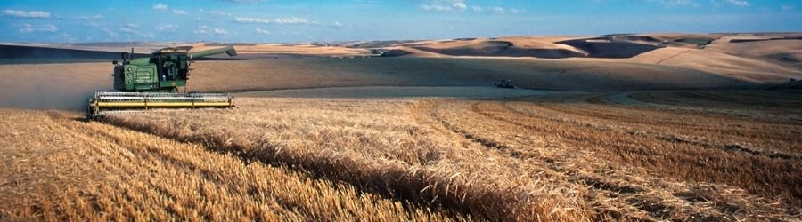
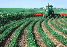
The development and implementation of precision agriculture or site-specific farming has been made possible by combining the Global Positioning System (GPS) and geographic information systems (GIS). These technologies enable the coupling of real-time data collection with accurate position information, leading to the efficient manipulation and analysis of large amounts of geospatial data. GPS-based applications in precision farming are being used for farm planning, field mapping, soil sampling, tractor guidance, crop scouting, variable rate applications, and yield mapping. GPS allows farmers to work during low visibility field conditions such as rain, dust, fog, and darkness.
In the past, it was difficult for farmers to correlate production techniques and crop yields with land variability. This limited their ability to develop the most effective soil/plant treatment strategies that could have enhanced their production. Today, more precise application of pesticides, herbicides, and fertilizers, and better control of the dispersion of those chemicals are possible through precision agriculture, thus reducing expenses, producing a higher yield, and creating a more environmentally friendly farm.
 Precision agriculture is now changing the way farmers and agribusinesses view the land from which they reap their profits. Precision agriculture is about collecting timely geospatial information on soil-plant-animal requirements and prescribing and applying site-specific treatments to increase agricultural production and protect the environment. Where farmers may have once treated their fields uniformly, they are now seeing benefits from micromanaging their fields. Precision agriculture is gaining in popularity largely due to the introduction of high technology tools into the agricultural community that are more accurate, cost effective, and user friendly. Many of the new innovations rely on the integration of on-board computers, data collection sensors, and GPS time and position reference systems.
Many believe that the benefits of precision agriculture can only be realized on large farms with huge capital investments and experience with information technologies. Such is not the case. There are inexpensive and easy-to-use methods and techniques that can be developed for use by all farmers. Through the use of GPS, GIS, and remote sensing, information needed for improving land and water use can be collected. Farmers can achieve additional benefits by combining better utilization of fertilizers and other soil amendments, determining the economic threshold for treating pest and weed infestations, and protecting the natural resources for future use.
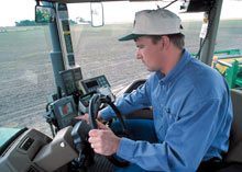
 GPS equipment manufacturers have developed several tools to help farmers and agribusinesses become more productive and efficient in their precision farming activities. Today, many farmers use GPS-derived products to enhance operations in their farming businesses. Location information is collected by GPS receivers for mapping field boundaries, roads, irrigation systems, and problem areas in crops such as weeds or disease. The accuracy of GPS allows farmers to create farm maps with precise acreage for field areas, road locations and distances between points of interest. GPS allows farmers to accurately navigate to specific locations in the field, year after year, to collect soil samples or monitor crop conditions.
Crop advisors use rugged data collection devices with GPS for accurate positioning to map pest, insect, and weed infestations in the field. Pest problem areas in crops can be pinpointed and mapped for future management decisions and input recommendations. The same field data can also be used by aircraft sprayers, enabling accurate swathing of fields without use of human “flaggers” to guide them. Crop dusters equipped with GPS are able to fly accurate swaths over the field, applying chemicals only where needed, minimizing chemical drift, reducing the amount of chemicals needed, thereby benefiting the environment. GPS also allows pilots to provide farmers with accurate maps.
Farmers and agriculture service providers can expect even further improvements as GPS continues to modernize. In addition to the current civilian service provided by GPS, the United States is committed to implementing a second and a third civil signal on GPS satellites. The first satellite with the second civilian signal was launched in 2005. The new signals will enhance both the quality and efficiency of agricultural operations in the future.
Benefits
- Precision soil sampling, data collection, and data analysis, enable localized variation of chemical applications and planting density to suit specific areas of the field.
- Accurate field navigation minimizes redundant applications and skipped areas, and enables maximum ground coverage in the shortest possible time.
- Ability to work through low visibility field conditions such as rain, dust, fog and darkness increases productivity.
- Accurately monitored yield data enables future site-specific field preparation.
- Elimination of the need for human "flaggers" increases spray efficiency and minimizes over-spray.
“We started using more digital technology in the last 10 years. We have gone to GPS (Global Positioning System) for a handful of different operations from cultivating to planting. By using GPS on the tractors, the entire process from leveling the field to planting the seed to irrigating the crop has been much more efficient than in the past. GPS is used in a lot of applications throughout most aspects of agriculture.”
John Boelts, Vice President of the Yuma County Farm Bureau, Yuma County, Arizona, USA


