 Official U.S. government information about the
Global Positioning System (GPS) and related topics
Official U.S. government information about the
Global Positioning System (GPS) and related topics

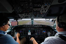
Aviators throughout the world use the Global Positioning System (GPS) to increase the safety and efficiency of flight. With its accurate, continuous, and global capabilities, GPS offers seamless satellite navigation services that satisfy many of the requirements for aviation users. Space-based position and navigation enables three-dimensional position determination for all phases of flight from departure, en route, and arrival, to airport surface navigation.
 The trend toward an Area Navigation concept means a greater role for GPS. Area Navigation allows aircraft to fly user-preferred routes from waypoint to waypoint, where waypoints do not depend on ground infrastructure. Procedures have been expanded to use GPS and augmented services for all phases of flight. This has been especially true in areas that lack suitable ground based navigation aids or surveillance equipment.
New and more efficient air routes made possible by GPS are continuing to expand. Vast savings in time and money are being realized. In many cases, aircraft flying over data-sparse areas such as oceans have been able to safely reduce their separation between one another, allowing more aircraft to fly more favorable and efficient routes, saving time, fuel, and increasing cargo revenue.
Improved approaches to airports, which significantly increase operational benefits and safety, are now being implemented even at remote locations where traditional ground-based services are unavailable. In some regions of the world, satellite signals are augmented, or improved for special aviation applications, such as landing planes during poor visibility conditions. In those cases, even greater precision operations are possible.
The good news for the aviation community is that GPS is being constantly improved and modernized. A main component of the ongoing civilian modernization effort is the addition of two new signals. These signals complement the existing civilian service. The first of these new signals is for general use in non-safety critical applications. The second new signal will be internationally protected for aviation navigational purposes. This additional safety-of-life civilian signal will make GPS an even more robust navigation service for many aviation applications.
 The second safety-of-life signal will enable significant benefits above and beyond the capabilities of the current GPS services. The availability of this signal offers increased instrument approach opportunity throughout the world by making the use of dual-frequency avionics possible. Dual frequency means that errors that occur in the signals due to disturbances in the ionosphere can be significantly reduced through the simultaneous use of two signals. This will improve the overall system robustness, to include accuracy, availability, and integrity, and will allow a precise approach capability with little or no ground infrastructure investment.
Reliance on GPS as the foundation for today and tomorrow's air traffic management system is a major part of many national plans. Those aviation authorities that are moving forward with GPS have observed and documented reductions in flight time, workload, and operating costs for both the airspace user and service provider. GPS also serves as an essential component for many other aviation systems, such as the Enhanced Ground Proximity Warning System (EGPWS) that has proven successful in reducing the risk of Controlled Flight into Terrain, a major cause of many aircraft accidents.
Note: The main text of this page has not been updated since 2006.
Benefits
- Continuous, reliable, and accurate positioning information for all phases of flight on a global basis, freely available to all.
- Safe, flexible, and fuel-efficient routes for airspace service providers and airspace users.
- Potential decommissioning and reduction of expensive ground based navigation facilities, systems, and services.
- Increased safety for surface movement operations made possible by situational awareness.
- Reduced aircraft delays due to increased capacity made possible through reduced separation minimums and more efficient air traffic management, particularly during inclement weather.
- Increased safety-of-life capabilities such as EGPWS.
“Ten of the major airports here in the Democratic Republic of the Congo now have the added capability of GPS approaches and departures. The satellite-based navigation system we are using is not dependent on expensive ground-based navigational aides, and it increases the safety and efficiency of our operations.”
Chris O'Brien, Deputy Chief of Aviation, MONUC/ICAO Project, Democratic Republic of the Congo


