 Official U.S. government information about the
Global Positioning System (GPS) and related topics
Official U.S. government information about the
Global Positioning System (GPS) and related topics
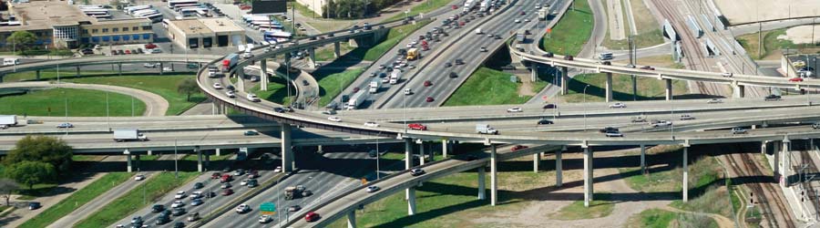
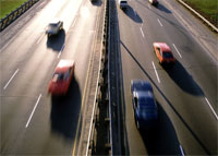
It is estimated that delays from congestion on highways, streets, and transit systems throughout the world result in productivity losses in the hundreds of billions of dollars annually. Other negative effects of congestion include property damage, personal injuries, increased air pollution, and inefficient fuel consumption.
The availability and accuracy of the Global Positioning System (GPS) offers increased efficiencies and safety for vehicles using highways, streets, and mass transit systems. Many of the problems associated with the routing and dispatch of commercial vehicles is significantly reduced or eliminated with the help of GPS. This is also true for the management of mass transit systems, road maintenance crews, and emergency vehicles.
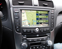 GPS enables automatic vehicle location and in-vehicle navigation systems that are widely used throughout the world today. By combining GPS position technology with systems that can display geographic information or with systems that can automatically transmit data to display screens or computers, a new dimension in surface transportation is realized.
A geographic information system (GIS) stores, analyzes, and displays geographically referenced information provided in large part by GPS. Today GIS is used to monitor vehicle location, making possible effective strategies that can keep transit vehicles on schedule and inform passengers of precise arrival times. Mass transit systems use this capability to track rail, bus, and other services to improve on-time performance.
Many new capabilities are made possible with the help of GPS. Instant car pools are feasible since people desiring a ride can be instantly matched with a vehicle in a nearby area.
Using GPS technology to help track and forecast the movement of freight has made a logistical revolution, including an application known as time-definite delivery. In time-definite delivery, trucking companies use GPS for tracking to guarantee delivery and pickup at the time promised, whether over short distances or across time zones. When an order comes in, a dispatcher punches a computer function, and a list of trucks appears on the screen, displaying a full array of detailed information on the status of each of them. If a truck is running late or strays off route, an alert is sent to the dispatcher.
 Many nations use GPS to help survey their road and highway networks, by identifying the location of features on, near, or adjacent to the road networks. These include service stations, maintenance and emergency services and supplies, entry and exit ramps, damage to the road system, etc. The information serves as an input to the GIS data gathering process. This database of knowledge helps transportation agencies to reduce maintenance and service costs and enhances the safety of drivers using the roads.
Research is underway to provide warnings to drivers of potential critical situations, such as traffic violations or crashes. Additional research is being conducted to examine the potential for minimal vehicle control when there is a clear need for action, such as the pre-deployment of air bags. The position information provided by GPS is an integral part of this research.
GPS is an essential element in the future of Intelligent Transportation Systems (ITS). ITS encompasses a broad range of communications-based information and electronics technologies. Research is being conducted in the area of advanced driver assistance systems, which include road departure and lane change collision avoidance systems. These systems need to estimate the position of a vehicle relative to lane and road edge with an accuracy of 10 centimeters.
With the continuous modernization of GPS, one can expect even more effective systems for crash prevention, distress alerts and position notification, electronic mapping, and in-vehicle navigation with audible instructions.
Note: The main text of this page has not been updated since 2006.
Benefits
- Higher levels of safety and mobility for all surface transportation system users.
- More accurate position determination to provide greater passenger information
- More effective monitoring to ensure schedule adherence, creating a transit system more responsive to transportation users needs.
- Better location information with electronic maps to provide in-vehicle navigation systems for both commercial and private users.
- Increased efficiencies and reduced costs in surveying roads.
“The promise of GPS technology for increasing safety and security, reducing congestion, and improving efficiency are limitless. Quite simply, GPS has become the enabling technology for transportation.”
Jeffrey N. Shane, Former Under Secretary for Policy, U.S. Department of Transportation


