 Official U.S. government information about the
Global Positioning System (GPS) and related topics
Official U.S. government information about the
Global Positioning System (GPS) and related topics
Trilateration Exercise
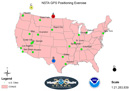
Download map (133 KB PDF) Download instructions as PDF (165 KB)
This page provides instructions and printable materials that teachers can use to introduce the concept of GPS trilateration to students.
The National Oceanic and Atmospheric Administration (NOAA) developed this material for demonstration at conferences of the National Science Teachers Association (NSTA). We also demonstrated it at STAT CAST 2014 in Dallas, Texas.
Be sure to print the map without scaling; otherwise, the calculated measurements of the strings will not work.
Activity: How to find a position using GPS
Orbiting the Earth are a number of Global Positioning System (GPS) satellites that can help determine your location on the planet. The concepts behind GPS positioning are very simple, but the application and implementation require amazing precision.
GPS positioning works on two basic mathematical concepts. The first is called trilateration, which literally means positioning from three distances. The second concept is the relationship between distance traveled, rate (speed) of travel and amount of time spent traveling, or:
Distance = Rate × Time
The first concept, trilateration, is the focus of this activity. It centers around finding your position on the Earth by knowing the location of orbiting GPS satellites and the distance from those satellites to your location on the planet. However, there is no way to actually take a yardstick, tape measure, etc., and measure the distance from your location up to the satellites. So how can we use trilateration if we can't physically measure the distances? The answer lies in the second concept, relating distance, rate and time. The trick lies in the fact that GPS satellites are always sending out radio signals.
In GPS positioning the rate is how fast the radio signal travels, which is equal to the speed of light (299,792,458 meters per second). Time is determined by how long it takes for a signal to travel from the GPS satellite to a GPS receiver on earth. With a known rate and a known time we can solve for the distance between satellite and receiver. Once we have the distance from at least 3 satellites, we can determine a 3 dimensional position on the surface of the earth.
To teach you the basic concept of how GPS works, we will conduct an exercise to demonstrate trilateration. Trilateration is determining a position by knowing your distance from at least 3 known points. In GPS those known points are the satellites themselves. It is important to understand that this is a simple exercise in trilateration itself, and not an exact representation of how the process of GPS positioning works. We will be using a flat map and string, when in reality the earth is round and the satellites are in the sky, not on the ground. Also, one often can "see" many more than three GPS satellites in the sky at any time, so we are going to use four points instead of just 3, to exemplify some of the issues surrounding extra satellites. This exercise should give you and your students a good example of how GPS positioning works.
This exercise is best done in groups of 3-4 people.
Materials:
- 4 pieces of different color string (pre-cut)
- Pencil or pen for marking the potential position of each signal
- A large map (provided)
Overview:
In this exercise we are going to simulate GPS positioning using 4 satellites. You are going to pretend to be a GPS receiver somewhere on the map and will figure out where you are based on the 4 "signals" you receive. But for you (and for a GPS receiver) all those signals tell you is where the satellite was when it sent the signal, and how long it took for the signal to get from the satellite to you. In other words, you have the time elapsed from when the signal left the satellite to when it arrived at your location. You also know where the satellite was when it sent you the signal, since the positions of the satellites are shown on the map. You need to determine where you could be, based on that amount of time elapsed. Since we know the speed of the signal (R), and the elapsed time (T), we can figure out the distance (D).
Distance = Rate × Time
In true 3 dimensional GPS positioning, the signals from the satellites are represented by spheres. For this exercise, we are going to use circles since we are on a 2 dimensional map. So, as a GPS receiver you need to figure out just how far from each satellite you are. Keep in mind you could be anywhere!
Directions:
- Lay the provided map flat on your table and tape down all four corners.
- Get 4 pieces of string, about 1/2 meter long,1 each of 4 colors. (We need to know how far away you are from 4 different points which are represented by the length of 4 different colors of string.)
- Determine exactly how long each string is supposed to be by solving our D = R × T equation. The speed of light (R) is 299,792,458 m / s. Use the amount of time that it takes for each signal to get from the satellites to the receiver provided below to solve for D.
Time for the Signals to reach the GPS receiver:- A = .00505783 seconds
- B = .00423206 seconds
- C = .00836090 seconds
- D = .00712225 seconds
Once you have figured out the distance each of our satellites is from our position on the ground, proceed to step 4 where you will calculate the scaled distances.
<-- Drag table to scroll -->Satellite A
String colorSatellite B
String colorSatellite C
String colorSatellite D
String colorTime (in seconds) .00505783 .00423206 .00836090 .00712225 Distance (m) 1516299.28784614 1268739.66980348 2506534.7620922 2135196.8339905 Scaled Distance (m) .07124 0.05961 0.11776 0.10032 Scaled Distance (cm) 7.12 5.96 11.76 10.03 - Now you know how long each string is supposed to be but the distances are a lot longer than the strings we cut. You need to account for the scale factor of the map. This map has a scale factor of 1:21,283,839. This means that 1 meter on the map equals 21,283,839 meters on the earth's surface. Using a simple proportion, figure out what the scaled version of your string should be. Convert the units to centimeters for easier measuring. [Note: In this shorter exercise, all the math has been done for you.] The single most important thing in this exercise is to make your string lengths as accurate as possible because you are going to be using your string to draw a circle showing all the possible places where the satellite signal could have gone in the given amount of time. In some cases, the circle may not fit on the paper and may just show up as an arc. You and your team should come up with a way to make those circles and arcs as precise as possible. Think about that for a minute before you cut your strings. Is there some inventive technique you can come up with to make your circles and arcs more precise? Cut your strings and get ready for the next step.
- Now you have four different strings, representing the distances from 4 satellites. Using whatever technique you came up with, go ahead and draw your circles and arcs using the satellite as the center point. This arc is a representation of where the satellite signal would be given the elapsed time. Remember, our position could be anywhere along that arc since that signal is traveling in all directions. Repeat this for String B and Dot B. You should see that there are at least two places where you could be! What were those two places?
Complete the process for Strings C and D. - Now you have a series of arcs and circles that overlap in a few places. But there should only be one place on the map where they all intersect each other.
Where are you?
Why didn't your lines all cross in exactly the same spot?
Take a look at how close you came. What would you say your level of accuracy was?
How does your accuracy compare to consumer grade GPS receivers?
How does your accuracy compare to Survey grade GPS receivers?
Wrap Up:
Of course GPS positioning is not quite that simple. In order to know the distance from the satellite to the receiver you need to know exactly where the satellite was when it sent its signal. That positional information is included in the signal that travels from the satellites. Also, the rate is not exactly the speed of light (it's really close though), as there are a variety of things that can cause delays, such as atmospheric conditions. There is also the problem of multi-path (signals bouncing off the ground or off of buildings), dilution of precision (really bad distribution of satellites in the sky) and other potential sources of error that was covered in the lecture. But for the most part, it really is that simple.


