 51st Meeting of the Civil GPS Service Interface Committee
At the Institute of Navigation GNSS 2011 Conference
Portland Convention Center
19-20 September 2011

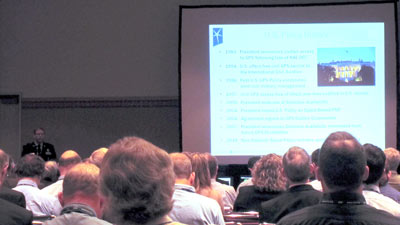
On the 25th anniversary of the forming of CGSIC, the 51st meeting of the Civil GPS Service Interface Committee was held September 19-20, 2011, at the Portland, Oregon, Convention Center in conjunction with the ION GNSS 2011 meeting.
Agenda
Monday, 19 September 2011
08:15 Registration
Morning Concurrent Sessions:
· International Information Session ·
John Wilde, Chair, IISC
09:00
Welcome remarks
John Wilde, Chair, CGSIC International Information Subcommittee
View presentation
(74 KB PDF)
09:15
Performance Based Navigation Update - Asia Pacific
Mr. Ian Mallett, CASA, Australia
View presentation
(5 MB PDF)
09:45
GLONASS Update
Dr. Sergey Revnivykh, Deputy Director General Roscosmos' Central Research Institute and Ekaterina Oleynik Information Service & International Relations Roscosmos’ Central Research Institute
View presentation
(4 MB PDF)
10:15
Current GNSS Activities in Japan
Mr. Hiroshi Nishiguchi, Japan GPS Council
View presentation
(3 MB PDF)
10:45
The UK Space Agency: An Update
Professor Terry Moore, Director of the Nottingham Geospatial Institute
View presentation
(2 MB PDF)
11:15
3D Nautical Charts: Cognitive Off-Loading Using an Egocentric Presentation Model
Dr. Thomas Porathe, Assistant Professor, Maritime Human Factors, Malardalen University/Chalmers University of Technology, Sweden
View presentation
(15 MB PDF)
11:45
GNSS Information System for Europe (GISE)
John Wilde, CEO DW International
View presentation
(1023 KB PDF)
12:15 Q&A
12:30 Session End
· U.S. States and Local Government Session
Rudy Persaud, Federal Highway Administration, Chair USS&LGSC
09:00
Welcome Remarks
CAPT Frank Parker, Commanding Officer NAVCEN, Deputy Chair CGSIC
09:05
Introductions
Rudy Persaud, Chair, U.S. States and Local Government Subcommittee of the Civil GPS Service Interface Committee
View presentation
(89 KB PDF)
09:15
Civil PNT Policy and Utility
Timothy Klein, NDGPS Coordinator and Senior Policy Advisor, USDOT/RITA
View presentation
(3 MB PDF)
09:40
Technology Efforts for Asset Management Integration
Laura Wipper, Oregon DOT
View presentation
(8 MB PDF)
10:05
Real Time Change Detection Using Laser Scanning and GNSS Real-time Networks
Michael J. Olsen, Assistant Professor, School of Civil and Construction Engineering, Oregon State University
View presentation
(8 MB PDF)
10:30 - 10:45 Break
10:45
Oregon Real-Time GPS Network Update
Ken Bays, Oregon DOT
View presentation
(5 MB PDF)
11:10
Establishing and Using a Real Time Network in Eastern Washington
James McLefresh, Spokane County
View presentation
(3 MB PDF)
11:35
Multimodal GNSS at Washington State Department of Transportation
Kurt Iverson, Washington State DOT
View presentation
(18 MB PDF)
12:00
Inertially-aided post-processed kinematic GPS for Nautical Charting Surveys
Jon Dasler, P.E., P.L.S. Vice President, Director of Marine Services - David Evans and Associates, Inc.
View presentation
(14 MB PDF)
12:25 Discussion
12:30 Meeting Adjourn
Afternoon Concurrent Sessions:
· Timing Session ·
Dr. Wlodzimierz Lewandowski, BIPM, Chair; Co-Chair: Victor Zhang, NIST
14:00
Introduction
Wlodzimierz Lewandowski, BIPM
View presentation
(71 KB PDF)
14:20
Report from NIST
Victor Zhang, NIST
View presentation
(1 MB PDF)
14:40
Report from USNO
Demetrios Matsakis, USNO
View presentation
(2 MB PDF)
15:00
Current activities of ITU-R WP7A
Ron Beard, NRL
View presentation
(187 KB PDF)
15:20 Break
15:40
Impact of Light Squared signal to timing applications
Jeffry Prillaman, USNO
16:00
Leap Second in digital networks
Judah Levine, NIST
View presentation
(2 MB PDF)
16:20
Metrologia Special Edition on Modern Time Scales
Felicitas Arias and Wlodzimierz Lewandowski, BIPM
View presentation 1
(138 KB PDF)
View presentation 2
(127 KB PDF)
16:40
Time and Navigation Exhibition at the Smithsonian: Coming Soon
Carlene E. Stephens, National Museum of American History
17:00 Discussion
17:30 Session End
· Surveying, Mapping, and Geosciences Session ·
Giovanni Sella, NOAA-National Geodetic Survey, Chair
14:00
Release of revised CORS coordinates, OPUS updates, Passive Control Readjustments
Giovanni Sella
View presentation
(3 MB PDF)
Antenna Calibrations at NGS with Emphasis on Absolute Antenna Calibrations
Andria Bilich, NOAA-NGS
View presentation
(851 KB PDF)
Forum on issues pertaining to CORS
17:30 Session End
Tuesday, 20 September 2011
08:00 Registration
CGSIC Plenary Session
09:00
Welcome/Opening
Karen VanDyke, Department of Transportation RITA, Chair, CGSIC
09:05
Meeting Overview
CAPT Frank Parker, Commanding Officer NAVCEN, Deputy Chair
09:10
Key Note Address
Peter H. Appel, Administrator, U.S. Department of Transportation Research and Innovative Technology Administration (RITA)
09:30
U.S. National Space-Based PNT Update
Col. Robert Hessin, Deputy Director, U.S. National Coordination Office for Space Based PNT
View presentation
(359 KB PDF)
09:50
GPS Program Update
Col. Bernard Gruber, Director, U.S. Air Force GPS Directorate
View presentation
(882 KB PDF)
10:10
GPS Constellation Status and Performance
LtCol Jennifer Grant, Commanding Officer, U.S. Air Force Second Space Operations Squadron
View presentation
(1 MB PDF)
10:30 Break
10:45
GPS International Activities
Ray Clore, Senior GPS Advisor, U.S. Department of State, Office of Space and Advanced Technology
View presentation
(95 KB PDF)
11:10
U.S. Interference Detection & Mitigation Plan (IDM)
John Merrill, PNT Program Manager, U.S. Department of Homeland Security, Geospatial Management Office
View presentation
(3 MB PDF)
11:35 Q/A Panel
12:00 - 13:30 Lunch
13:30 Subcommittee Reports
Report from International Information Subcommittee
John Wilde, DW International
View presentation
(44 KB PDF)
Report from Timing Subcommittee
Dr. Wlodzimierz Lewandowski, BIPM
View presentation
(199 KB PDF)
Report from U.S. States and Local Government Subcommittee
Rudy Persaud, FHWA
View presentation
(846 KB PDF)
Report from Surveying, Mapping, and Geosciences Subcommittee
Giovanni Sella, NGS
View presentation
(2 MB PDF)
14:10
WAAS and LAAS Program Status
Leo Eldredge, GNSS Program Manager, Federal Aviation Administration, U.S. Department of Transportation
View presentation
(6 MB PDF)
14:30
NDGPS Program Update
Timothy Klein, U.S. Department of Transportation, RITA
View presentation
(3 MB PDF)
14:50
User Support Forum
Hank Skalski, U.S. Department of Transportation
View presentation
(3 MB PDF)
Improving GPS.gov - Jason Kim, U.S. National Coordination Office for Space-Based PNT
View presentation
(2 MB PDF)
15:10 Light Squared GPS Interference Test Results
15:30 Break
15:50
GPS User Perspective
"United We Stand, Divided We Fall, And If Our Backs Should Ever Be Against The Wall." - Alan Cameron, Editor in Chief, GPS World Magazine
View presentation
(38 KB PDF)
16:10
Change Management Process for Public Signals In Space Documents
Capt Neil Petersen, Chief, Engineering Requirements Branch, U.S. Air Force GPS Directorate
View presentation
(851 KB PDF)
16:30 Q/A Panel (Presenters)
17:30 Adjourn
 Official U.S. government information about the
Global Positioning System (GPS) and related topics


